Health & Fitness
Civic Center 1970?
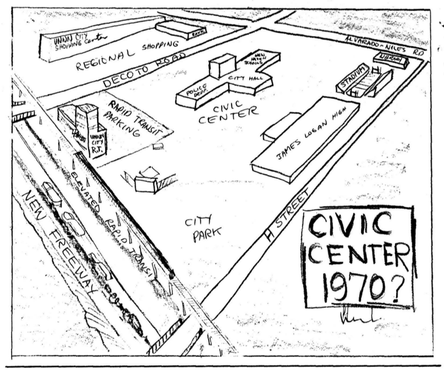
In February, 1965, the Union City Leader published a drawing of the area around James Logan High School and entitled the drawing "Civic Center 1970?". The previous week there were articles on the Union City Civic Improvement Committee which was looking into creating a Civic Center with City Hall and a Police Department, and the School District's approval to create a stadium at James Logan High School.
The map shows the stadium to the right of James Logan High School and next to it a library. The stadium was built as shown and the first Union City library was located in a portable building next to the stadium.
The map shows the proposed are for the Civic Center about where the El Mercado Shopping center is located. Where Kennedy Park is located, the map shows the BART station. And where there are homes near the corner of H Street and the railroad tracks, the map shows a city park along with a baseball field. BART was proposed to be on an elevated track along the railroad tracks, which the map show, and this did come to fruition. Next to the railroad tracks is a "new freeway". This was one route of the proposed 238, known as the "Foothill Freeway".
Find out what's happening in Union Citywith free, real-time updates from Patch.
The map the Union City Shopping Center where Safeway is now located. This was a small mall type shopping center that was demolished to create the current center where Safeway is located.